
Master Plan Documents
2022 HOUSING ELEMENT.pdf
Adobe Acrobat document [24.3 MB]
Adobe Acrobat document [24.3 MB]
2021 MASTER PLAN REEXAMINATION REPORT.pd[...]
Adobe Acrobat document [6.6 MB]
Adobe Acrobat document [6.6 MB]
2010 ReExamination Report.pdf
Adobe Acrobat document [91.1 KB]
Adobe Acrobat document [91.1 KB]
2010 Land Use Plan Amendment.pdf
Adobe Acrobat document [58.9 KB]
Adobe Acrobat document [58.9 KB]
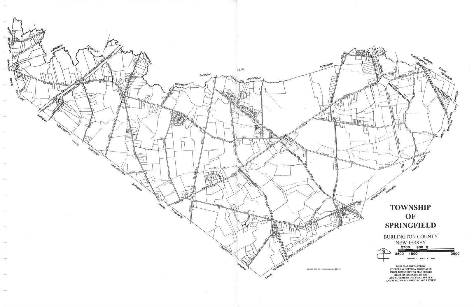
1 Base Map 1.jpg
JPG image [170.6 KB]
JPG image [170.6 KB]

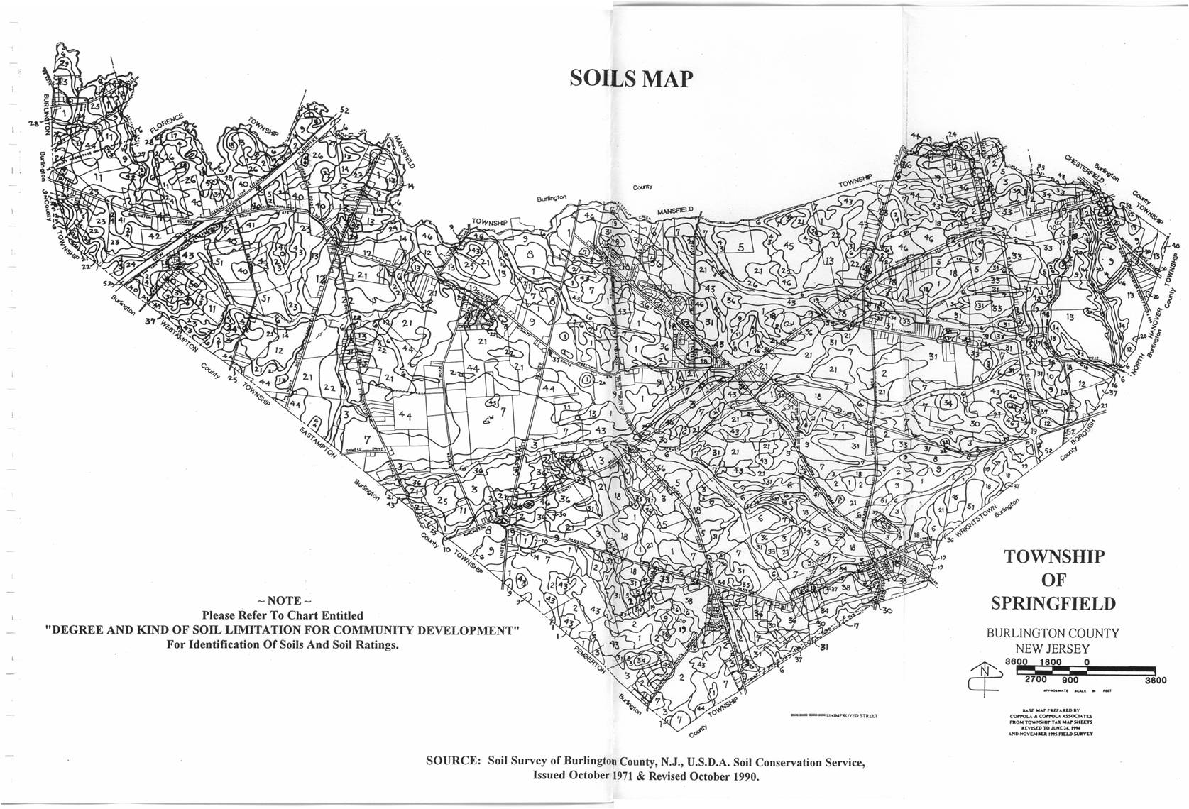
2 Soils Map.jpg
JPG image [348.3 KB]
JPG image [348.3 KB]

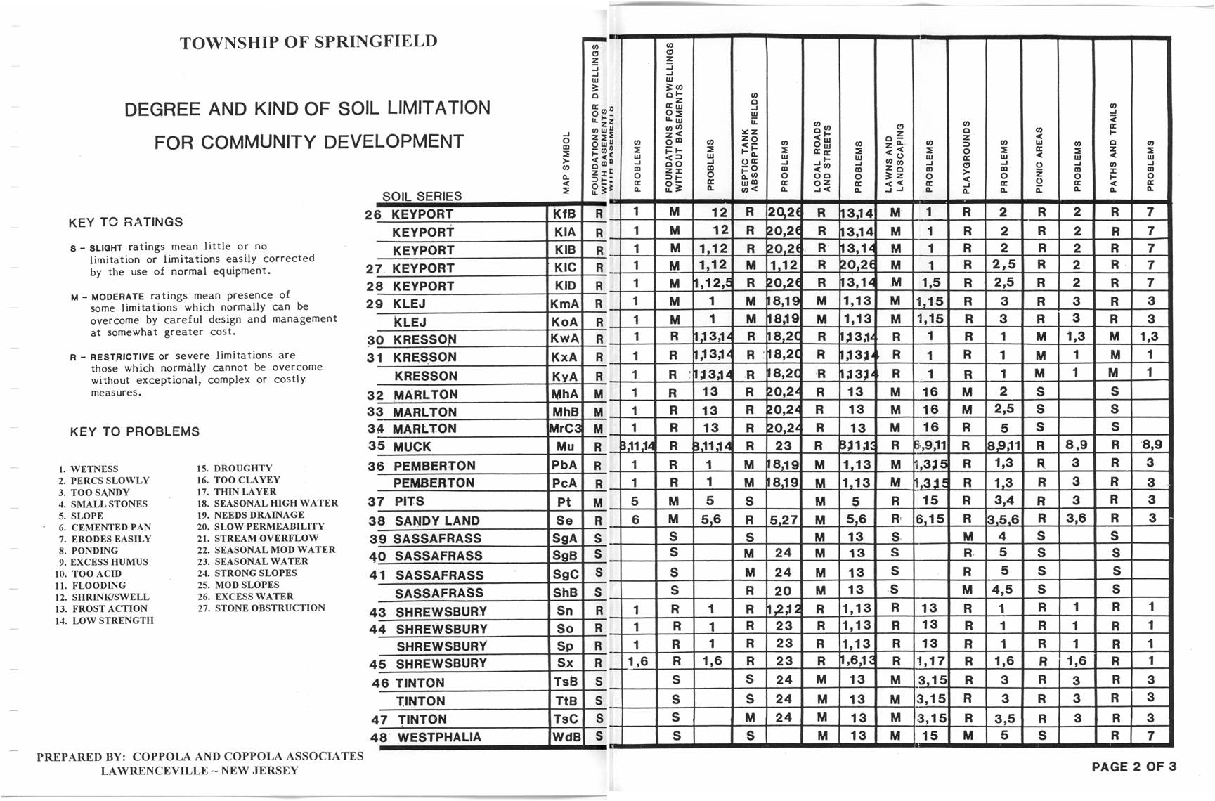
3 Degree soil.jpg
JPG image [304.6 KB]
JPG image [304.6 KB]
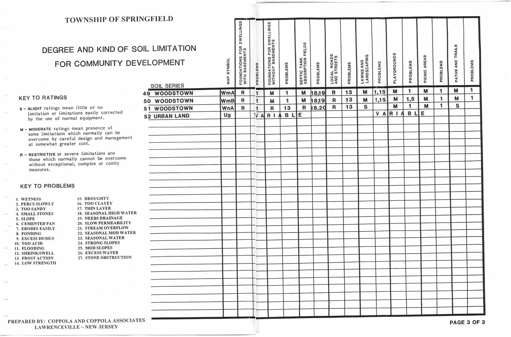
4 Degree soil.jpg
JPG image [305.9 KB]
JPG image [305.9 KB]
5 Degree soil.jpg
JPG image [228.9 KB]
JPG image [228.9 KB]

6 soil limit.jpg
JPG image [313.6 KB]
JPG image [313.6 KB]

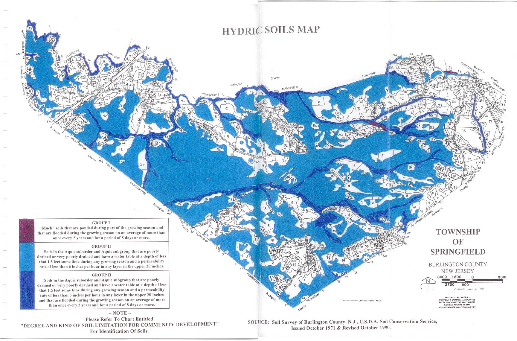
7 Hydric Soils.jpg
JPG image [337.8 KB]
JPG image [337.8 KB]
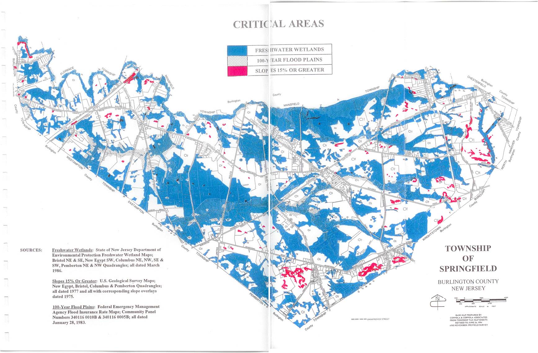
8 Critical Areas.jpg
JPG image [290.0 KB]
JPG image [290.0 KB]

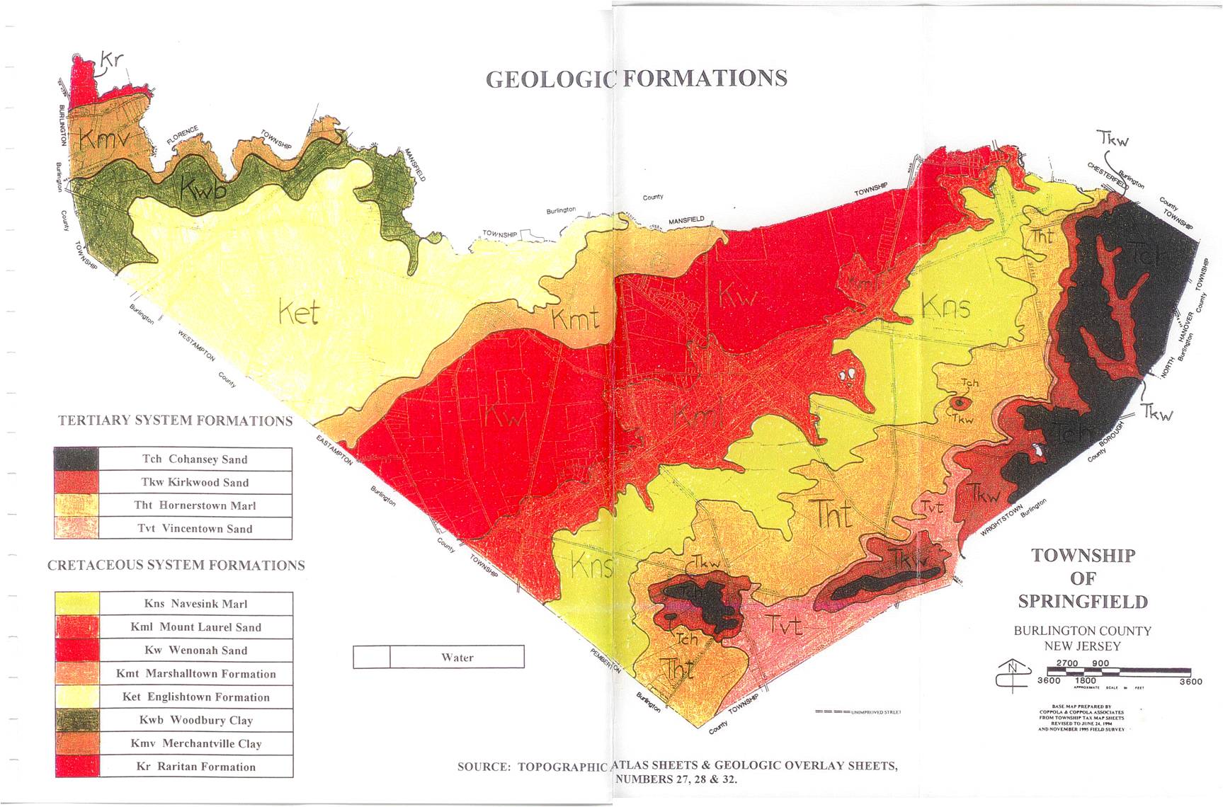
9 Geol Form.jpg
JPG image [262.7 KB]
JPG image [262.7 KB]
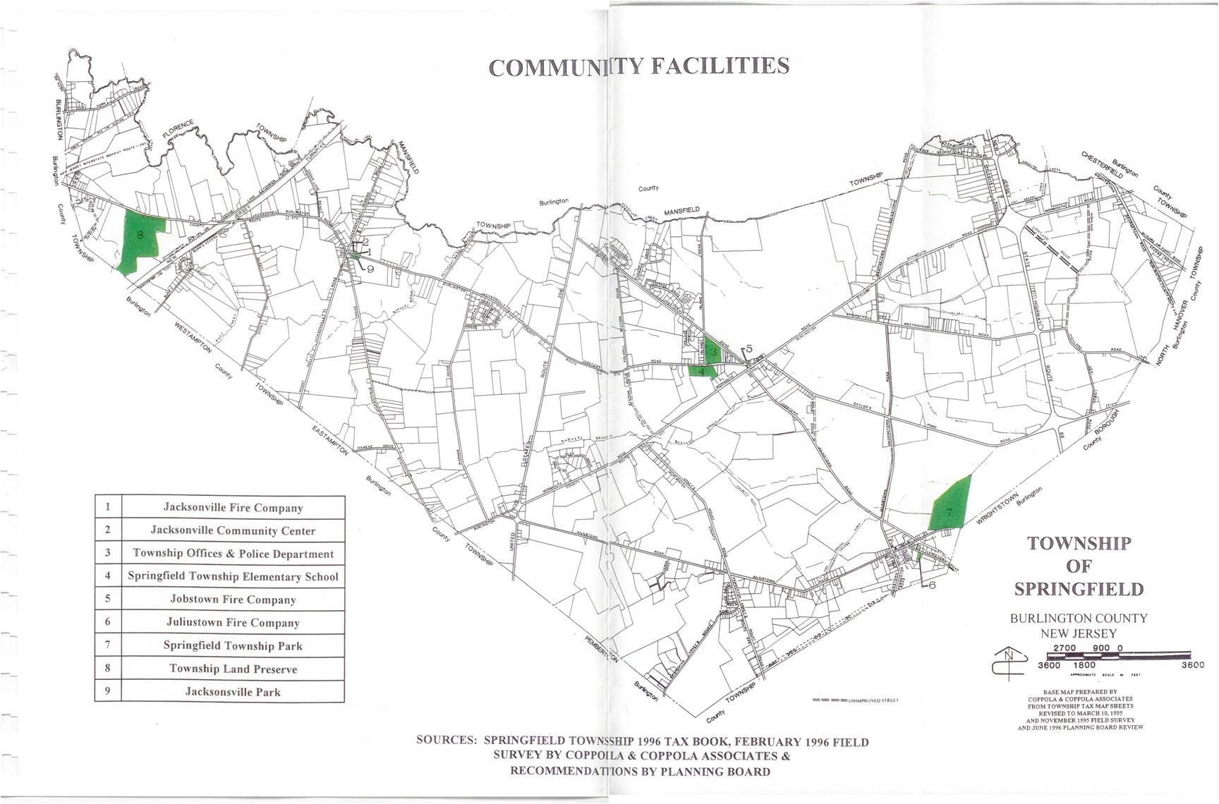
10 Comm Fac.jpg
JPG image [217.8 KB]
JPG image [217.8 KB]

11 Sewe.jpg
JPG image [214.1 KB]
JPG image [214.1 KB]

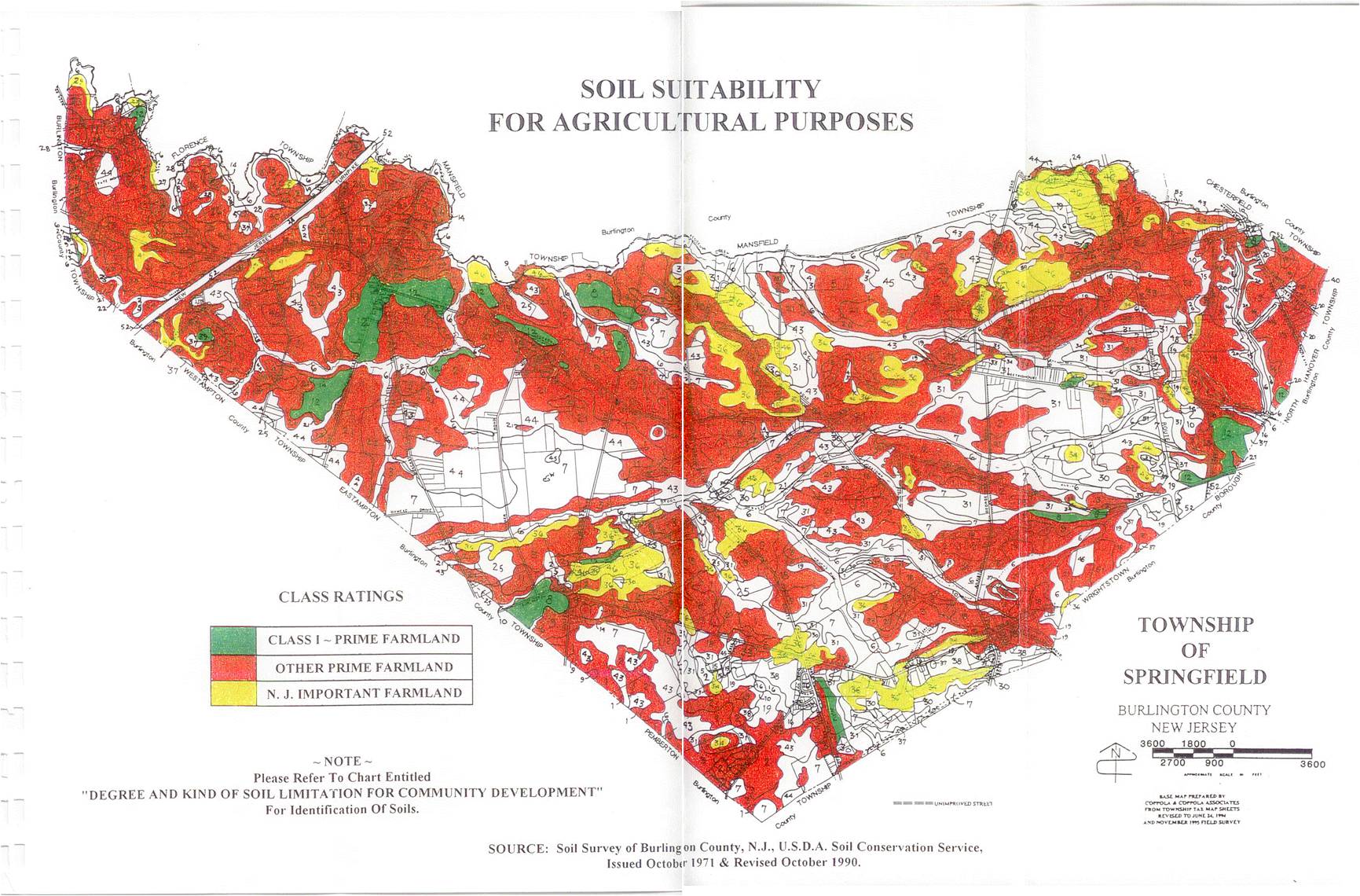
12 soil suit.jpg
JPG image [336.1 KB]
JPG image [336.1 KB]

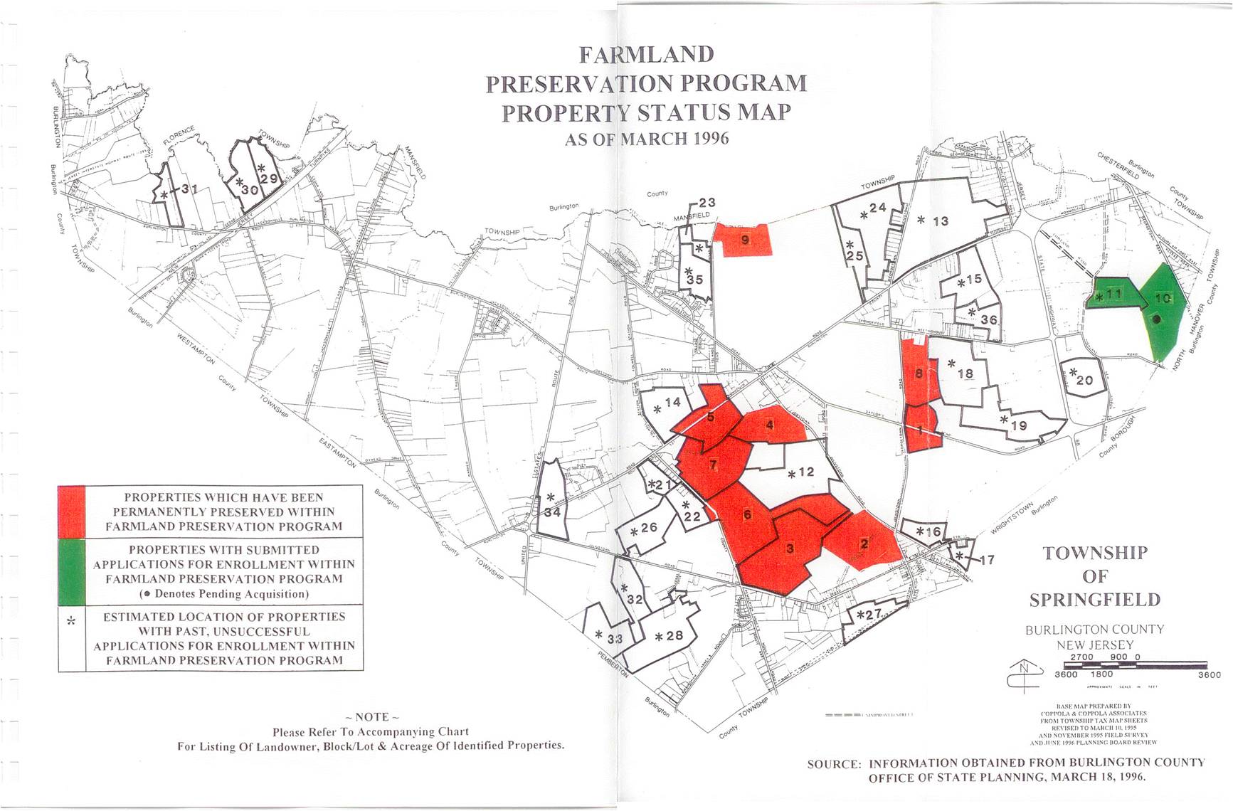
13 prop status.jpg
JPG image [230.5 KB]
JPG image [230.5 KB]

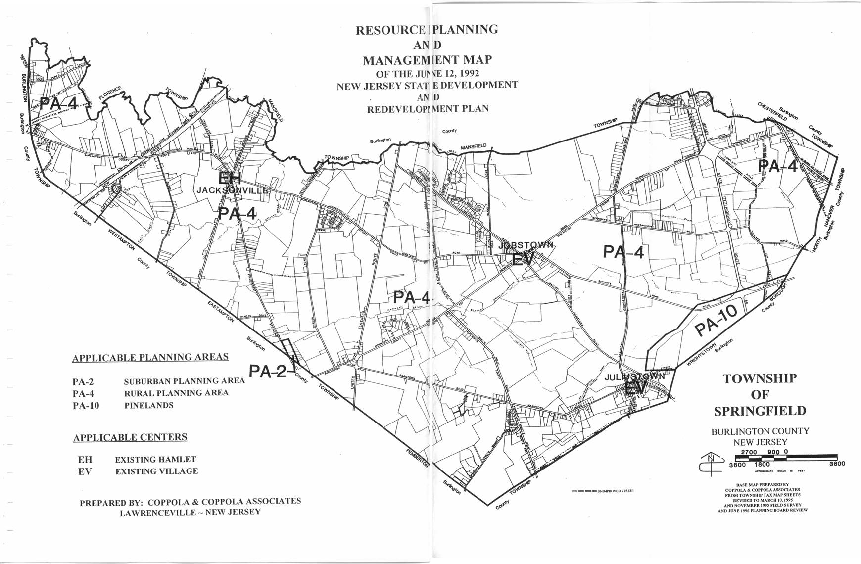
14 res planning.jpg
JPG image [238.5 KB]
JPG image [238.5 KB]
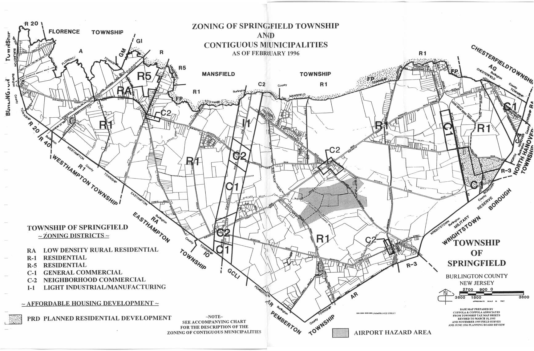
15 zoning and other towns.jpg
JPG image [302.4 KB]
JPG image [302.4 KB]
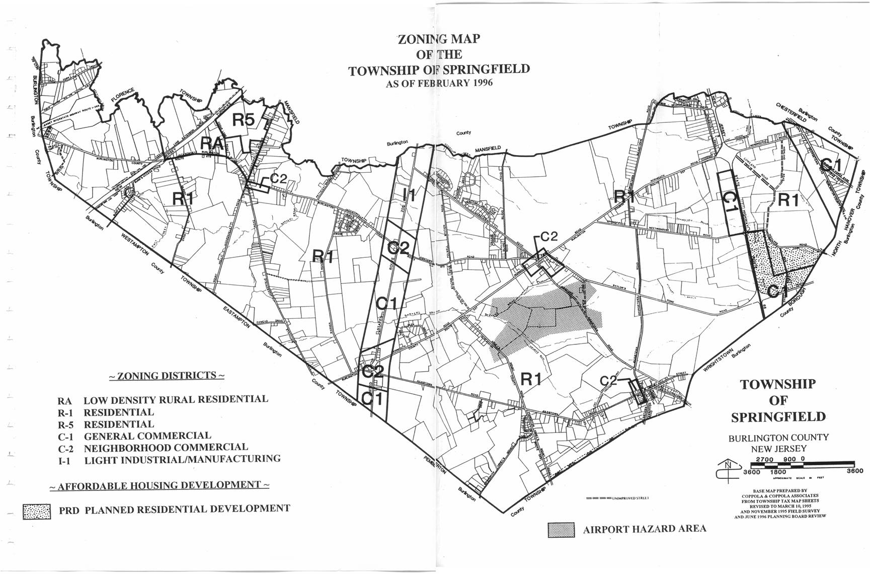
16 zoning.jpg
JPG image [256.5 KB]
JPG image [256.5 KB]
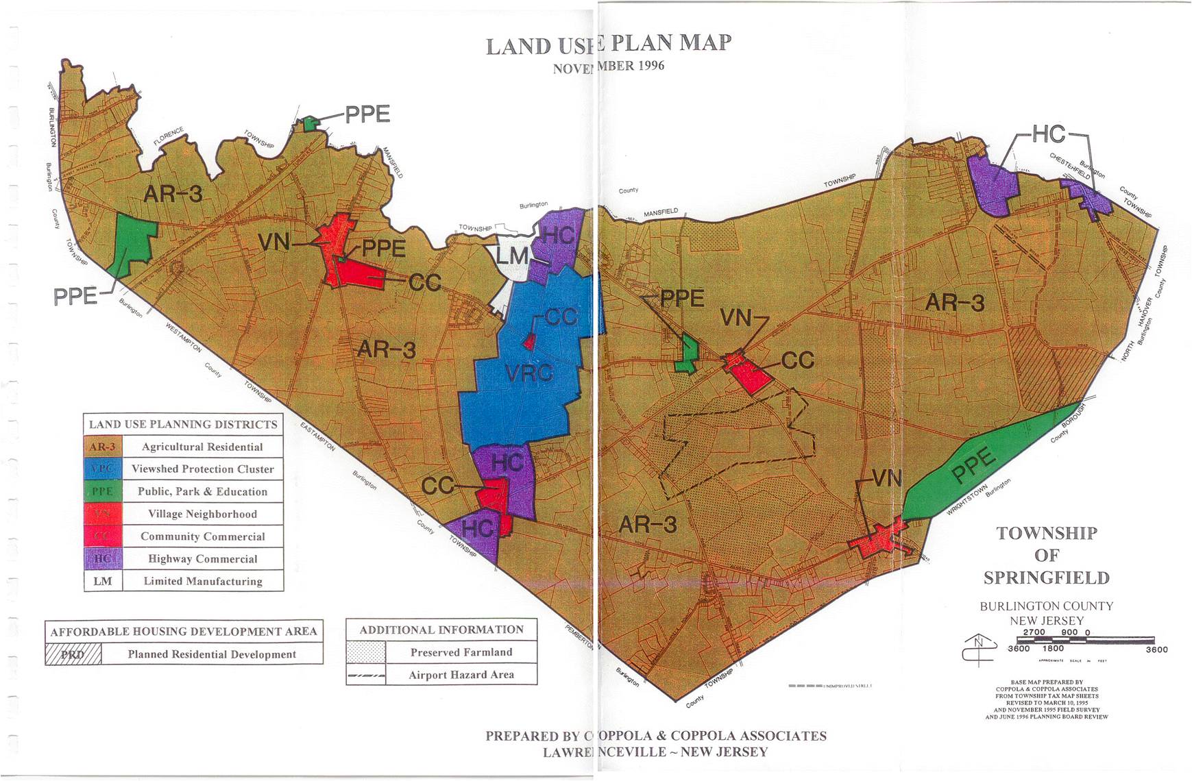
17 land use.jpg
JPG image [278.4 KB]
JPG image [278.4 KB]

18 crit areas.jpg
JPG image [289.1 KB]
JPG image [289.1 KB]
ZONING MAP 2009.pdf
Adobe Acrobat document [858.7 KB]
Adobe Acrobat document [858.7 KB]
2008 HOUSING ELEMENT AND FAIR SHARE PLAN[...]
Adobe Acrobat document [5.8 MB]
Adobe Acrobat document [5.8 MB]
2005 Reexamination Report.pdf
Adobe Acrobat document [111.0 KB]
Adobe Acrobat document [111.0 KB]
2005 Land Use Plan Amendment.pdf
Adobe Acrobat document [4.3 MB]
Adobe Acrobat document [4.3 MB]
2003 Farmland Preservation.pdf
Adobe Acrobat document [427.7 KB]
Adobe Acrobat document [427.7 KB]
2002 master plan amendment.pdf
Adobe Acrobat document [481.1 KB]
Adobe Acrobat document [481.1 KB]
2001 Land Use Element.pdf
Adobe Acrobat document [1.3 MB]
Adobe Acrobat document [1.3 MB]
2000 Land Use Amendment.pdf
Adobe Acrobat document [675.3 KB]
Adobe Acrobat document [675.3 KB]
Springfield Master Plan.pdf
Adobe Acrobat document [13.4 MB]
Adobe Acrobat document [13.4 MB]

1 Base Map 1.jpg
JPG image [170.6 KB]
JPG image [170.6 KB]
2 Soils Map.jpg
JPG image [348.3 KB]
JPG image [348.3 KB]
3 Degree soil.jpg
JPG image [304.6 KB]
JPG image [304.6 KB]

4 Degree soil.jpg
JPG image [305.9 KB]
JPG image [305.9 KB]

6 soil limit.jpg
JPG image [313.6 KB]
JPG image [313.6 KB]
7 Hydric Soils.jpg
JPG image [337.8 KB]
JPG image [337.8 KB]

8 Critical Areas.jpg
JPG image [290.0 KB]
JPG image [290.0 KB]
9 Geol Form.jpg
JPG image [262.7 KB]
JPG image [262.7 KB]

10 Comm Fac.jpg
JPG image [217.8 KB]
JPG image [217.8 KB]

11 Sewe.jpg
JPG image [214.1 KB]
JPG image [214.1 KB]
12 soil suit.jpg
JPG image [336.1 KB]
JPG image [336.1 KB]
13 prop status.jpg
JPG image [230.5 KB]
JPG image [230.5 KB]
14 res planning.jpg
JPG image [238.5 KB]
JPG image [238.5 KB]

15 zoning and other towns.jpg
JPG image [302.4 KB]
JPG image [302.4 KB]

16 zoning.jpg
JPG image [256.5 KB]
JPG image [256.5 KB]

17 land use.jpg
JPG image [278.4 KB]
JPG image [278.4 KB]

18 crit areas.jpg
JPG image [289.1 KB]
JPG image [289.1 KB]